
ATAK Plugin: TAKSat
1K+
Downloads

Everyone
info
About this app
ATTENTION: This is an ATAK Plugin. To use this extended capability, the ATAK baseline must be installed. Download the ATAK baseline here: https://play.google.com/store/apps/details?id=com.atakmap.app.civ
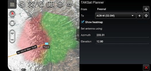
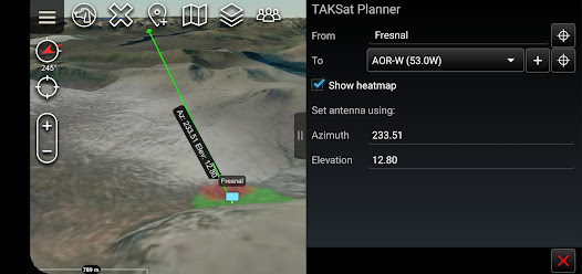
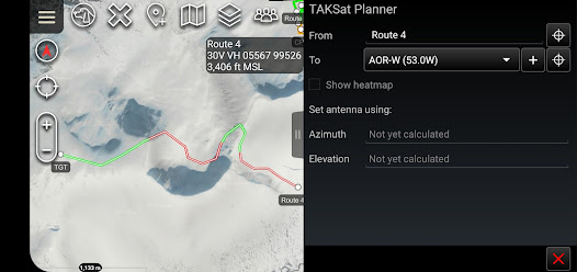
The TAKSat Planner tool calculates the Azimuth and Elevation required to achieve communication with a Geostationary satellite.
When available, it uses Digital Terrain Elevation Data (DTED) to determine terrain masking and whether communications are likely to be achieved. This can be from a fixed point or along a route. The tool can also generate a heatmap around a selected ground location to determine where in the local area communications are likely to be achievable from.
The plugin is pre-loaded with Immarsat BGAN satellites but users are able to quickly add other satellites.
A PDF manual for the plugin can be found at -> "Settings/Tool Preferences/Specific Tool Preferences/TAKSat Planner Preferences".
Best efforts are being made to keep the Open Beta Testing of this plugin updated to the same version as ATAK-CIV. Therefore if this plugin is outdated compared to your ATAK installation please consider signing up as a Beta Tester. Unfortunately, whilst feedback is appreciated, we can give no guarantees that requested features will be implemented.
Updated on
Safety starts with understanding how developers collect and share your data. Data privacy and security practices may vary based on your use, region, and age. The developer provided this information and may update it over time.

No data shared with third parties
Learn more about how developers declare sharing

No data collected
Learn more about how developers declare collection
What's new
Initial release of geostationary satellite planner for ATAK


