Topographia Classic
Contains ads
1K+
Downloads

Everyone
info

About this app
"Topographia Classic" is a suite of land surveying tools. It allows you to have complex surveying calculations on the field quickly with maximum accuracy. The design is as simple as needed under work pressure. The advantage is that can be used only with a simple total station or additionally with more complex instruments and gps.
Angular units : gradians (default) and decimal degrees (degrees only in Distance/Azimuth).
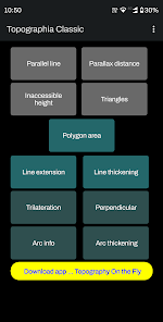
Task list:
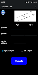
Parallel lines
Parallax distance
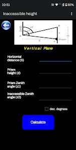
Inaccessible height
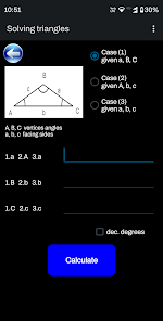
Triangles solution
Polygon Area
Line extension
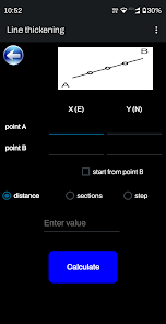
Line thickening
Trilateration
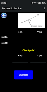
Perpendicular line
Arc information
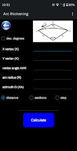
Arc thickening
Great tool for land surveyors, civil engineers, topographers and land engineers.
Download also our free application:
"Geodetic NET" from Google play
https://play.google.com/store/apps/details?id=com.GeodeticNET&hl=en
"Surveying In the Field" from Google play
https://play.google.com/store/apps/details?id=com.Surveying.IntheField&hl=en
"Topography On the Fly" from Google play
https://play.google.com/store/apps/details?id=com.TopOgraphy.OntheFly&hl=en&gl=US&pli=1
Don't forget to rate this app and send us a feedback.
Angular units : gradians (default) and decimal degrees (degrees only in Distance/Azimuth).
Task list:
Parallel lines
Parallax distance
Inaccessible height
Triangles solution
Polygon Area
Line extension
Line thickening
Trilateration
Perpendicular line
Arc information
Arc thickening
Great tool for land surveyors, civil engineers, topographers and land engineers.
Download also our free application:
"Geodetic NET" from Google play
https://play.google.com/store/apps/details?id=com.GeodeticNET&hl=en
"Surveying In the Field" from Google play
https://play.google.com/store/apps/details?id=com.Surveying.IntheField&hl=en
"Topography On the Fly" from Google play
https://play.google.com/store/apps/details?id=com.TopOgraphy.OntheFly&hl=en&gl=US&pli=1
Don't forget to rate this app and send us a feedback.
Updated on
Safety starts with understanding how developers collect and share your data. Data privacy and security practices may vary based on your use, region, and age. The developer provided this information and may update it over time.

No data shared with third parties
Learn more about how developers declare sharing

No data collected
Learn more about how developers declare collection

Data is encrypted in transit

Data can’t be deleted


