
Database
50+
Downloads

Rated for 3+
info
About this app
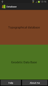
Final solution so you can keep all the information, all your projects, a database designed to store survey points.
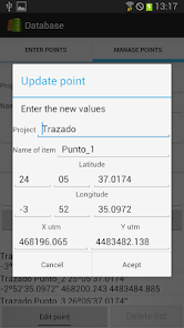
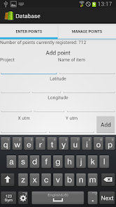
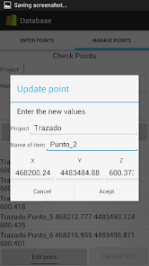
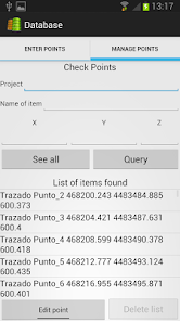
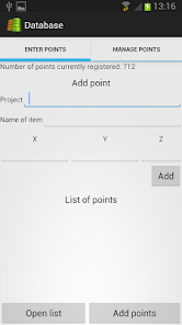
Can you classify points per project, point name, and their respective coordinates. Prepared for Surveying and Geodesy.
Compatible with the Wizard applications Topography, Topography - Earthworks, Geodesy, Surveying and reviews.
You can put all the information in text files that were working normally within the database, and you always have them ready, without the risk of losing the corresponding text file.
Updated on
Safety starts with understanding how developers collect and share your data. Data privacy and security practices may vary based on your use, region, and age. The developer provided this information and may update it over time.

No data shared with third parties
Learn more about how developers declare sharing

No data collected
Learn more about how developers declare collection
What's new
Two new fields to the base of geodetic data, the orthometric height and ellipsoidal height is added.


