
Trimble Novapoint GO
1K+
Downloads

Everyone
info

About this app
Trimble Novapoint GO is a navigation and documentation tool for site managers, control engineers, design engineers and contractors. It is designed to aid navigation around construction sites, relative to reference lines or construction objects. There is also functionality to link information and pictures to a given location.
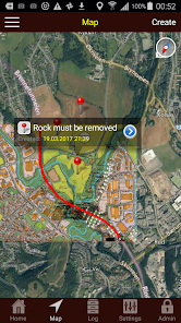
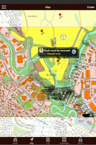
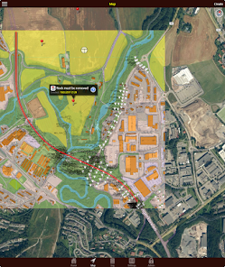
Trimble Novapoint GO displays your position relative to a selected reference line on a map. It shows your geographical location, the chainage and distance to the reference line.You can use Trimble Novapoint GO to create GPS-positioned log points, add text descriptions and use the iPhone camera to add associated pictures. All log points are automatically transferred to a server, making them available for collaboration with other users.
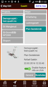
In Trimble Novapoint GO you can add WMS layers, and add Plan Data from a Trimble Quadri model. All layers of information can be made transparent, so you can view all selected information at the same time.
There are extra features for Geotechnical engineers. If you have the Geotechnic license, you can add location of new borehole, investigation methods, area for visible rock surface. You can also connect to a Quadri server, where you have the existing boreholes, and click on them to view information.
Trimble Novapoint GO is a supplementary tool for Novapoint users and requires a login account.
Trimble Novapoint GO displays your position relative to a selected reference line on a map. It shows your geographical location, the chainage and distance to the reference line.You can use Trimble Novapoint GO to create GPS-positioned log points, add text descriptions and use the iPhone camera to add associated pictures. All log points are automatically transferred to a server, making them available for collaboration with other users.
In Trimble Novapoint GO you can add WMS layers, and add Plan Data from a Trimble Quadri model. All layers of information can be made transparent, so you can view all selected information at the same time.
There are extra features for Geotechnical engineers. If you have the Geotechnic license, you can add location of new borehole, investigation methods, area for visible rock surface. You can also connect to a Quadri server, where you have the existing boreholes, and click on them to view information.
Trimble Novapoint GO is a supplementary tool for Novapoint users and requires a login account.
Updated on
Safety starts with understanding how developers collect and share your data. Data privacy and security practices may vary based on your use, region, and age. The developer provided this information and may update it over time.

No data shared with third parties
Learn more about how developers declare sharing

This app may collect these data types
Location

Data is encrypted in transit

You can request that data be deleted
What's new
- Bug fixes
- API upgrades
- API upgrades