
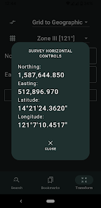
Survey Horizontal Controls
100+
Downloads

Everyone
info
About this app
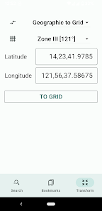
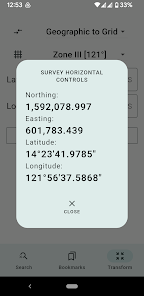
A database of commonly used Philippine survey reference points, grouped by region. This app is useful for geodetic engineers, cartographers, CAD users, and real property consolidators who need to plot parcels of land in the correct projection (LPCS, Grid, or PRS'92).
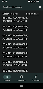
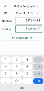
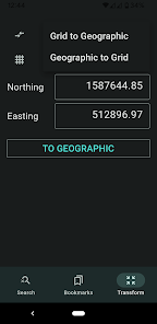
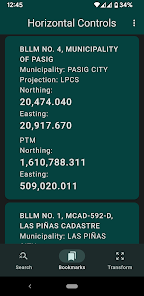
Search for the correct Northings and Eastings (y and x coordinates) of BLLMs, MBMs, BBMs, cadastral reference monuments, and more. Simply tap the magnifying glass icon, select the region where the reference point is located, and enter the monument number and survey/cadastral number to find it.
(Note for rooted Android device users: This app will not run on rooted device.)
Updated on
Safety starts with understanding how developers collect and share your data. Data privacy and security practices may vary based on your use, region, and age. The developer provided this information and may update it over time.

No data shared with third parties
Learn more about how developers declare sharing

No data collected
Learn more about how developers declare collection