
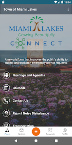
Miami Lakes Connect
100+
Downloads

Everyone
info
About this app
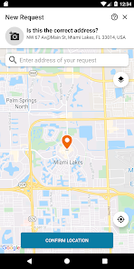
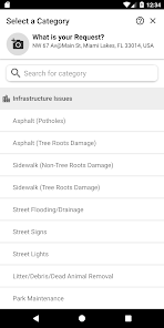
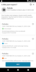
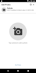
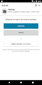
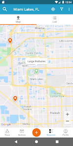
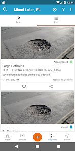
For those potholes, damaged street signs, and other local problems that need attention, the Miami Lakes Connect app makes reporting a problem easier than ever. This app uses GPS to recognize your location and gives you a menu of common quality-of-life conditions to select from. The app allows you to upload pictures or videos to accompany your request. The mobile app can also be used for a variety of other requests as well and then residents can track the status of reports they or other members of the community have submitted.
Updated on
Safety starts with understanding how developers collect and share your data. Data privacy and security practices may vary based on your use, region, and age. The developer provided this information and may update it over time.

No data shared with third parties
Learn more about how developers declare sharing

This app may collect these data types
Location, Personal info and 5 others

Data is encrypted in transit

You can request that data be deleted
What's new
- Upgrade to Android 13


