

Mesh code to display the latitude, longitude.
You can specify a visual map latitude, longitude.
Mesh Code is used in Japanese area.
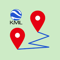
I made it mainly to display KML file exported from Casio's activity...

*OverviewYou can change the color of the image in various ways.You can...
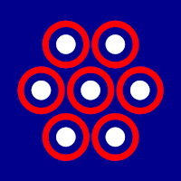
*Overview A tool for counting objects in an image and obtaining their...

*How to useAdjust the shape of the heart with the height, width...

*How to useEnter characters.Adjust scale, ratio, rotation, position, etc.Create an image with...
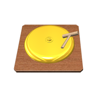
*How to useTap the gong image.Adjust volume and pitch.*functionvolume controlpitch controlkeyboard functionTwo...
Created with AppPage.net
Similar Apps - visible in preview.