


EasyTrails GPS is the GPS tracker application for your device.
The perfect application for those who are passionate about OUTDOOR ACTIVITIES and TRAVELING, everybody who likes outdoor sports, and not only.
Are you going for a bike or motorcycle ride? Well, EasyTrails GPS will tell you how many miles you traveled, how much time you spent, how high you climbed and many other details. In real-time it will show you the course on a map, comparing it with downloaded tracks and points of interest.
Export your tracks in standard formats, so you can review them on Google Earth, SportTracks and TrailsRunner. Or simply upload them to online services like Garmin Connect, or many others.
Calculate routes and let EasyTrails guide you with turn directions. You can also let it guide you through previously recorded tracks.
It's possible to import tracks by e-mail or web browser (GPX/KML/KMZ file formats).
Load custom cartography, EasyTrails supports MBTILES format.
EasyTrails GPS is easy to use and extremaly accurate. It ensures the maximum duration of battery thanks to the possibility of recording in "StandBy" mode. However, be aware that use of GPS, even in background, will have a significant impact on battery duration.
► For more info, visit our website: www.easytrails.com
NEW FEATURES:
► Heart rate monitoring (paid)
We added the ability to connect to compatible Bluetooth heart rate monitors (such as Polar H6 and H7 devices). Heart rate can be seen in real time from the dashboard.
With the 'Heart rate monitoring' in-app purchase:
- heart rate data will be associated to GPS tracks
- saved tracks will have an extra heart rate chart
- heart rate data can be saved to Google Fit
Additionally, with the 'Colored tracks' in-app purchase, it will be possible to highlight heart rate data directly on the map screen of a recorded track.
OTHER FEATURES:
- Support for many different map types
- Support for user-loaded offline cartography (KMZ and MBTILES)
- Export tracks (single or multiple) in standard formats (GPX, KML, KMZ, CVS), with their associated waypoints, pictures and rich metadata
- Import tracks and waypoints (GPX, KML, KMZ)
- Resume recording of tracks
- Save waypoints with photos and descriptions
- Calculate routes and navigate with turn directions
- Real-time visualization of distance, speed, altitude bearing and other data
- Map Visualization in different modes: street map, satellite, hybrid, terrain
- Charts (elevation profiles, ...)
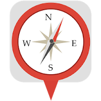
- Digital Compass
- Heart rate monitoring
- High battery duration (record in standby)
- Intuitive and User Friendly interface
- Lightweight, reliable and accurate
- Doesn't require internet connection except for displaying online cartography
If GeoTag runs properly, please, put a 5* rating and a comment...

SpotOn GPS Fence offers dogs and dog owners a reliable and convenient...

No matter if you travel to Bali for two weeks or you...


Created with AppPage.net
Similar Apps - visible in preview.