Yawa: U.S. Weather
Current U.S. weather, forecasts, radar, and tide predictions for your location
About Yawa: U.S. Weather
Yawa - Yet Another Weather App
Yawa provides weather, radar, tide predictions and satellite images from National Oceanic and Atmospheric Administration (NOAA) public APIs and Internet services (https://www.weather.gov/documentation/services-web-api) based on your current location or a location of your choice within the continental United States, Alaska, Hawaii, Puerto Rico, US Virgin Islands, and Guam.
Disclaimer: Yawa is neither endorsed by or affiliated with NOAA. This information is provided using publicly available NOAA APIs and Internet services.
Yawa contains no ads and is free to use.
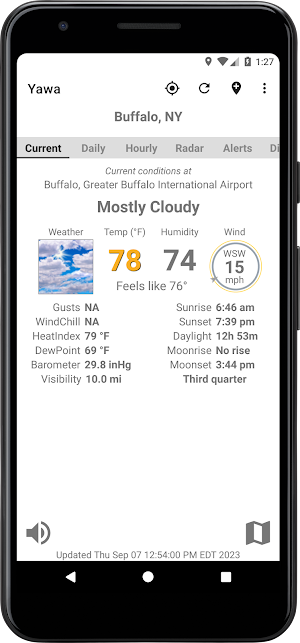
With location permission, Yawa will display the current weather conditions and forecast for the National Weather Service (NWS) grid point at the current location of the device. Yawa will continue to operate without location permission but will be unable to provide weather information for your current location automatically.
Search for a specific location by City, St or Zipcode - or specify any point on the interactive map to retrieve current weather information. Save locations for later access.
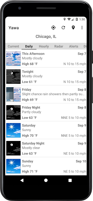
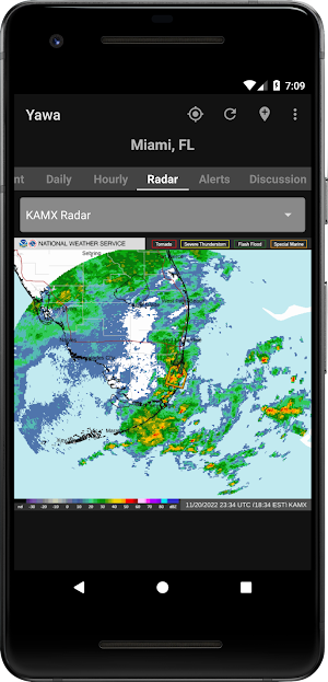
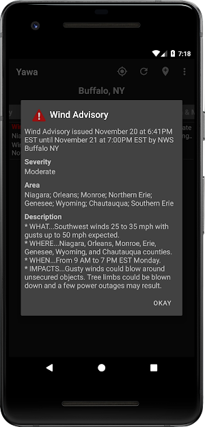
Yawa uses a tabbed layout to display current conditions, detailed daily forecasts and hourly forecasts, animated radar images, forecast alerts, satellite images, local and national forecast discussions, nearby tide predictions, sun and moon rise/set times, and an interactive map.
Features
• Current conditions as reported by the closest NWS observation station.
• Detailed daily and nightly forecasts for the next seven days.
• Hourly forecasts for the next seven days.
• Text-to-speech for current conditions and forecasts.
• Animated radar image from the closest radar station.
• Animated regional radar images.
• Watches, warnings, advisories for the current zone.
• Current area forecast discussion from the local weather service forecast office.
• National short range, extended, tropical weather, and space weather forecasts discussions.
• Sun and Moon rise/set times at the current location for the next 30 days.
• NOAA 30 day tide predictions from stations within a 25 mile radius of the selected location.
• Latest NOAA GOES-East and GOES-West satellite images for the Continental United States, Pacific United States, Alaska, Hawaii and the Caribbean.
• Interactive map of nearby weather, radar, tide prediction observation stations and zoned forecast alerts.
Configure
• Light or dark theme
• Latitude, longitude coordinate format
• Display units (metric, US Standard)
• Geocoder
• Startup options
Similar Apps

My Hurricane Tracker Pro
Comprehensive forecasts and maps for tracking hurricanes, tornadoes and cyclones

Water Country USA
Maps, Experiences, Park Hours

Foreca Weather & Radar
Very accurate, clean and convenient weather app which is widely customizable.

Tyfoom | Engagement Platform
Engagement Platform for Employee Communication and Training

FOX10 Weather Mobile Alabama
The FOX10 Weather App gives you the latest weather for our viewing region.

Emergency: Severe Weather App
Plan for a tornado, hurricane, or earthquake. Receive local weather alerts
