GPS Map Camera & Timestamp
GPS map camera editor - stamp location, address, date & weather onto your photos

About GPS Map Camera & Timestamp
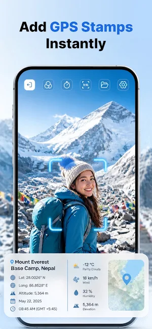
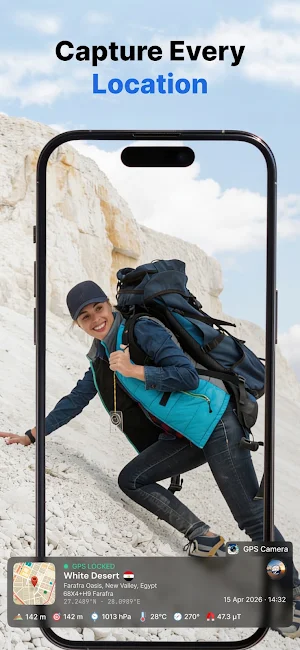
Take a photo and it's stamped instantly — map, address, GPS coordinates, date, time and weather, right on the image. That's it. No typing, no second app, no forgetting where you were.
GPS Map Camera & Timestamp is built for anyone who needs a photo to prove something: that you were on site, that the delivery arrived, that the crack in the wall looked like this on that date. It's also just a nice way to remember where you took a picture.
WHAT IT DOES
Open the camera and shoot. A live map appears on your photo along with the full street address, GPS coordinates and a clear timestamp. Everything is burned into the image, so the proof stays with the photo wherever you send it.
THE EDITOR
Most GPS camera apps give you one stamp and that's it. This one has a proper photo editor.
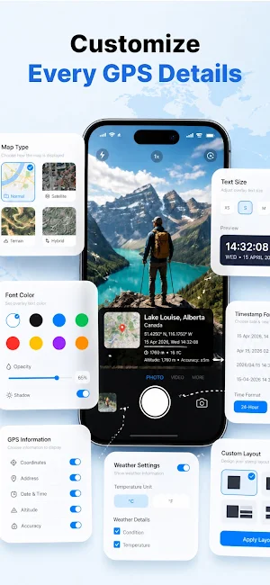
Move the map anywhere on the frame, resize it, or switch the map style
Change how the date and time are formatted
Show or hide the address, latitude, longitude and altitude
Add your own notes — a job number, a client name, a room number
Adjust font, colour, opacity and position
Edit the stamp after you've taken the photo, not just before
Start from a template if you'd rather not fiddle. There are presets for site work, inspections, deliveries, travel and everyday photos.
MORE THAN JUST LOCATION
Along with the address and coordinates, you can include weather conditions, temperature, altitude, compass bearing and GPS accuracy. Useful when the conditions matter — and they often do.
TURN PHOTOS INTO A PDF REPORT
Select your photos and export them as a clean PDF. Site progress, property inspections, proof of delivery, service call records — the paperwork writes itself. Email it or share it straight from the app.
WHO USES IT
Site managers logging progress week by week
Estate agents recording property visits
Couriers capturing proof of delivery
Engineers and technicians proving a job was completed
Surveyors and inspectors building photo records
Travellers who want to remember exactly where that photo was taken
HOW IT WORKS
Open the app and pick a template
Take your photo
Tweak the stamp in the editor if you want to
Save it, share it, or export a PDF report
Free to download. Works with cached maps when your signal drops. Give it a try — and if something's missing, tell us. We read every review.
Similar Apps

Sea Trials - USCG License Exam
Upgrade USCG License

Trails Offroad: Offline Maps
Offroad and overland trail guides for offline use.

BlackVue
Companion app for BlackVue dashcams, featuring BlackVue Over the Cloud.

PhotoPills
Discover How to Plan any Sun, Moon and Milky Way Photo You Imagine in Seconds
GPS Map Camera
Add Map/Address/LatLng/Weather/Date to your photo when camera capture.