


Routes planning and offline GPS navigator for hiking and cycling
Alminav is designed for hikers, cyclists, and other outdoor enthusiasts. One of its main advantages is that it can function offline, as signals in the rural areas are often very weak. Maps can be downloaded in advance, and are vectored so as to not take up a lot of space in the phone's storage. Navigation works offline with downloaded maps.
FEATURES
• Offline detailed hiking maps
• Offline route calculation with altitude profile
• Offline search for cities, streets and pois
• Record GPS tracks as KML or GPX file
• Map display in the direction of movement
• Elevation charts
• Velocity charts
• Map styles can be choosed
• Map layers for contourlines and waymarked cycletrails
RECTANGULAR MAP TILES
The map tiles are all the same size and cover the rectangular area from one longitude and one latitude. Example: The tile n48e005 covers the area between the latitudes north 48° and 49° and between the longitudes east 5° and 6° (area about 100x100km). These tiles have a small download size, the route calculation is fast, they cover large parts of Europe.
For the area of Germany, marked cycleways can be displayed in the 3D view.
Country Maps
Country maps are less detailed than the map tiles, no contour lines are displayed and only car-navigation is possible.
• Austria
• Belgium
• Denmark
• France
• Germany,
• Greece
• Italy
• Netherlands
• Poland
• Spain
• Switzerland
• Czech Republic
• Hungary
Maps are based on the data of OpenStreetMap (OSM).
UPGRADE
The limitation of maps import can be removed by in app purchases. One map tile can be imported for free.
APIS
• Vector maps rendering: http://wiki.openstreetmap.org/wiki/Mapsforge
• Route calculation: http://graphhopper.com
• Map download: https://firebase.google.com/
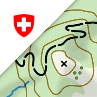
On the road with the best app of the year: the swisstopo...

FATMAP is the #1 app for mountain sports.Explore the mountains with confidence...

Nautical map (The Netherlands) is an online waterway chart and almanac which...

The C-MAP app provides high-quality nautical maps along with navigation, traffic and...

A clearly structured navigation app with intuitive and comprehensive tools for navigation...

Tropter it is an interactive map / travel guide presenting the most...


Created with AppPage.net
Similar Apps - visible in preview.